Around Me
Search
List
Map
Combined
+
+
Guide
Europe
Germany
Austria
Italy
Switzerland
France
Spain
Greece
Czech Republic
Liechtenstein
Iceland
Great Britain and Northern Ireland
Romania
Slovakia
Ireland
Belgium
Denmark
Norway
Finland
Netherlands
Portugal
Malta
Sweden
Serbia
Lithuania
Slovenia
Hungary
Ukraine
North America
USA
Canada
Costa Rica
Oceania
New Zealand
Australia
Asia
Japan
United Arab Emirates
China
Iran
Georgia
India
Azerbaijan
Turkey
Russia
Africa
Egypt
South Africa
South America
Brazil
Hiking
Europe
Austria
Germany
Italy
Switzerland
Liechtenstein
France
Iceland
Romania
Belgium
Ireland
Norway
Great Britain and Northern Ireland
Denmark
Sweden
Portugal
North America
USA
Canada
Oceania
New Zealand
Australia
Biking
Europe
Austria
Germany
Switzerland
Italy
Romania
Spain
Liechtenstein
Great Britain and Northern Ireland
Lithuania
Finland
France
Iceland
Ireland
North America
Canada
USA
Swimming
Europe
Austria
Germany
Switzerland
Italy
Romania
Iceland
Slovenia
Spain
Netherlands
Ireland
Malta
Great Britain and Northern Ireland
Hungary
North America
Canada
USA
Attractions
Europe
Germany
Austria
Italy
France
Switzerland
Spain
Greece
Czech Republic
Slovakia
Great Britain and Northern Ireland
Iceland
Belgium
Netherlands
Ireland
Denmark
Norway
Finland
Portugal
Malta
Liechtenstein
Romania
Serbia
Sweden
Ukraine
Hungary
Slovenia
North America
USA
Canada
Costa Rica
Oceania
New Zealand
Australia
Asia
Japan
United Arab Emirates
China
Russia
Iran
Georgia
India
Azerbaijan
Turkey
Africa
Egypt
South Africa
South America
Brazil
Magazine
News
Award
Active
Culture
Tips
Specials
On Tour
Inside
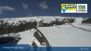
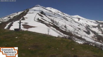
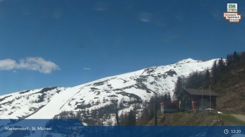
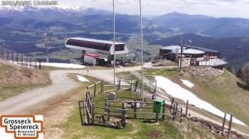
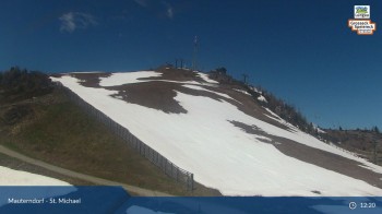
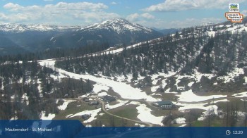
Webcam Aineck: Katschberghöhe, 1,850 m
Hike
Weather For Hikers
Webcams
Wall
Photos
Circuit Trail Oberweißburg
Hike
Photos
Weather For Hikers
Webcams
Hikes
Europe
Austria
Tyrol
Salzburg
Salzburg's world of sport
Grossarltal
Zell am See - Kaprun
Saalbach-Hinterglemm
Gasteinertal
Lungau
Hochkönig
Nationalpark Hohe Tauern
Obertauern
Saalfelden-Leogang
Saalachtal
Styria
Vorarlberg
Carinthia
Upper Austria
Lower Austria
Vienna
Burgenland
Germany
Italy
Switzerland
Liechtenstein
France
Iceland
Denmark
Great Britain and Northern Ireland
All countries in Europe
Romania
Norway
Ireland
Sweden
Belgium
Portugal
North America
USA
Canada
Oceania
New Zealand
Australia
Magazine
News
Award
Active
Culture
Tips
All magazine categories
Specials
On Tour
Inside
Misc.
The Perfect Match
Travel Guide
Map
Sweepstakes
Surveys
© Feratel
Your view of Katschberghoehe Aineck.
Webcam broken? Description wrong?
Please, share your knowledge with our staff. Tell us what is wrong with this webcam.
E-Mail
Message
Send
Elevation:
1,850
m
Today's webcam images (Local Time: 3 May 2024 00:52)
Latest
Webcam archive
Advertisement
Travel Deals & Tips
Advertisement
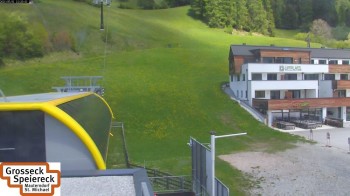
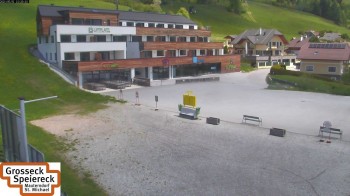
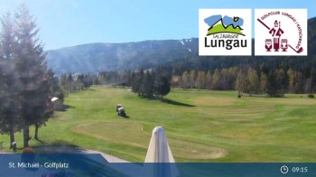
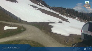
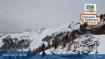
Webcams nearby
Mid station Aineck
Sonnenbahn in St. Michael
St. Michael (1.000m)
St. Michael: Golf Course
Peterbauerkreuz (2.010 m)
Sonnalmbahn / Oberfeld Alm
View of Trogalmkessel
Grosseckbahn - Panorama Alm
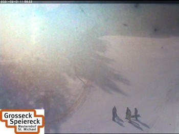
Grosseck - View towards Speiereck
Panorama Alm (1.950m)
Top station gondola Grosseck
Grosseckbahn Sender Top Station
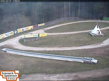
Kid's Park Mauterndorf
Base of Mauterndorf
Hikes Nearby
Circuit Trail Oberweißburg
3.9
km
Snowshoeing near Oberweissburg in Lungau Austria
6.9
km
Advertisement
Login
E-Mail
Password
Login
Forgot your password?
You don't have an account yet? Click here to get one.
Login with Facebook
Login with Google+
Share your personal insider tip and create new entries
Explore fantastic outdoor destinations when and where you want
Find your dream destination or discover the world on the interactive map

 Latest