Around Me
Search
List
Map
Combined
+
+
Guide
Europe
Germany
Austria
Italy
Switzerland
France
Spain
Greece
Liechtenstein
Iceland
Czech Republic
Great Britain and Northern Ireland
Romania
Slovakia
Ireland
Belgium
Denmark
Norway
Finland
Netherlands
Portugal
Malta
Sweden
Serbia
Lithuania
Slovenia
Hungary
Ukraine
North America
USA
Canada
Costa Rica
Oceania
New Zealand
Australia
Asia
Japan
United Arab Emirates
China
Iran
Georgia
India
Azerbaijan
Turkey
Russia
Africa
Egypt
South Africa
South America
Brazil
Hiking
Europe
Austria
Germany
Italy
Switzerland
Liechtenstein
France
Iceland
Romania
Belgium
Ireland
Norway
Great Britain and Northern Ireland
Denmark
Sweden
Portugal
North America
USA
Canada
Oceania
New Zealand
Australia
Biking
Europe
Austria
Germany
Switzerland
Italy
Romania
Spain
Liechtenstein
Great Britain and Northern Ireland
Lithuania
Finland
France
Iceland
Ireland
North America
Canada
USA
Swimming
Europe
Austria
Germany
Switzerland
Italy
Romania
Iceland
Slovenia
Spain
Netherlands
Ireland
Malta
Great Britain and Northern Ireland
Hungary
North America
Canada
USA
Attractions
Europe
Germany
Austria
Italy
France
Switzerland
Spain
Greece
Czech Republic
Slovakia
Great Britain and Northern Ireland
Iceland
Belgium
Netherlands
Ireland
Denmark
Finland
Portugal
Malta
Liechtenstein
Norway
Romania
Serbia
Sweden
Ukraine
Hungary
Slovenia
North America
USA
Canada
Costa Rica
Oceania
New Zealand
Australia
Asia
Japan
United Arab Emirates
China
Russia
Iran
Georgia
India
Azerbaijan
Turkey
Africa
Egypt
South Africa
South America
Brazil
Magazine
News
Award
Active
Culture
Tips
Specials
On Tour
Inside
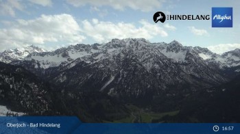
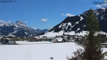
Webcam Bergstation Hahnenbahn Hindelang, 5072 ft
Hike
Weather For Hikers
Webcams
Wall
Photos
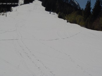
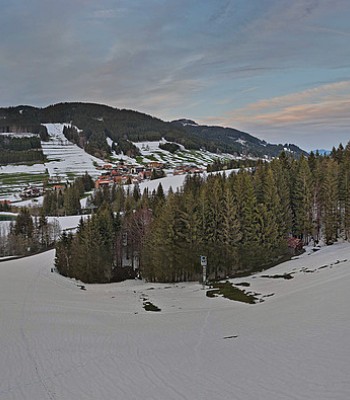
Zipfelalpe
Hike
Photos
Weather For Hikers
Webcams
Hikes
Europe
Austria
Tyrol
Paznaun - Ischgl
Zillertal
Stubai
Tannheimer Tal
St.Anton am Arlberg
East Tyrol
Tyrolean Oberland
Alpbachtal Seenland
Region Seefeld
Wildschönau
Pitztal
Kitzbühel Alps - St. Johann - Oberndorf - Kirchdorf
Pillerseetal
Kitzbühel
Lechtal
Region Hall - Wattens
Tyrolean Zugspitz Arena
Kaiserwinkl
Ötztal
Tyrol West
First tourist region in Zillertal
Kitzbühel Alps - Brixental
Ferienregion Imst
Innsbruck and its holiday villages
Naturparkregion Reutte
Silberregion Karwendel
Salzburg
Styria
Vorarlberg
Carinthia
Upper Austria
Lower Austria
Vienna
Burgenland
Germany
Italy
Switzerland
Liechtenstein
France
Iceland
Denmark
Great Britain and Northern Ireland
All countries in Europe
Romania
Norway
Ireland
Sweden
Belgium
Portugal
North America
USA
Canada
Oceania
New Zealand
Australia
Magazine
News
Award
Active
Culture
Tips
All magazine categories
Specials
On Tour
Inside
Misc.
The Perfect Match
Travel Guide
Map
Sweepstakes
Surveys
16:30
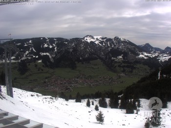
Panoramic view of Hornalp and the slopes at Hindelang
Webcam broken? Description wrong?
Please, share your knowledge with our staff. Tell us what is wrong with this webcam.
E-Mail
Message
Send
Elevation:
1,546
m
Today's webcam images (Local Time: 18:31)
23:00
01:00
03:00
05:00
06:00
07:00
09:00
11:00
13:00
15:00
Latest
Webcam archive
Advertisement
Travel Deals & Tips
Advertisement
Webcams nearby
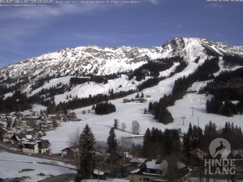
Mountain station Hornbahn
View of the slopes and top station of Wannenjochbahn
Kids hotel Oberjoch: view at the nature reseve "Allgäuer Hochalpen"
View of the kids hotel Oberjoch at the slopes in front
Panoramic view of the mountain station Oberjoch
Spieserlifte Unterjoch View of the ski run
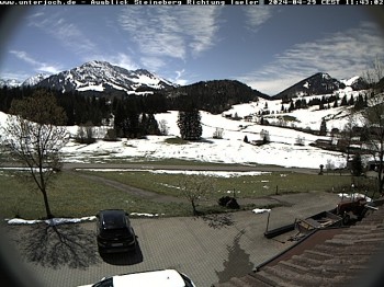
Unterjoch - line of vision Oberjoch
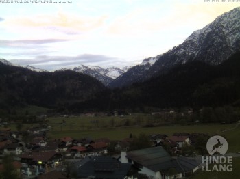
View of the church Bad Hindelang
Panorama of the base station Wannejochbahn
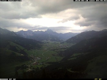
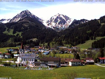
Schattwald: Vacation rental Haus Romantika
Hotel Wildanger - Zöblen
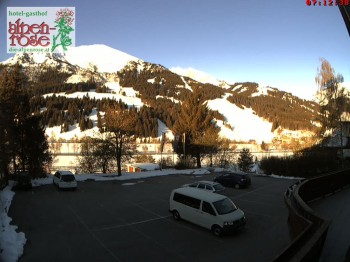
Webcam located at the Gasthof Alpenrose Zöblen
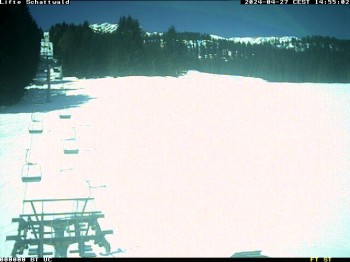
Ski Resort Schattwald Zöblen
mountain "Sorgschrofen" above Jungholz
Panorama view Sorgschrofen lift
N'Ice Bear kid's area, skiresort Jungholz
Nearby
From Zoeblen to Einstein summit
0.4
km
Loop trail Lohmoos
0.4
km
Zipfelalpe
1.7
km
Show all
From Tannheim to Einstein summit
2.8
km
Barefoot loop Tannheim
2.8
km
Vilsalpsee
5.1
km
From Bad Hindelang to Oberjoch
8.2
km
Through the Birkental valley
11.1
km
Hike Heaven Hotspur Path - Allgäu Hiking Trilogy
29
km
Water Runner Path - Allgäu Hiking Trilogy
48.2
km
Advertisement
Login
E-Mail
Password
Login
Forgot your password?
You don't have an account yet? Click here to get one.
Login with Facebook
Login with Google+
Share your personal insider tip and create new entries
Explore fantastic outdoor destinations when and where you want
Find your dream destination or discover the world on the interactive map


 23:00
23:00  01:00
01:00  03:00
03:00 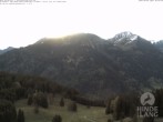 05:00
05:00 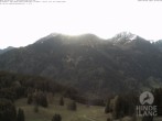 06:00
06:00 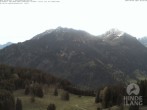 07:00
07:00 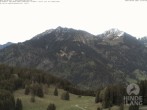 09:00
09:00 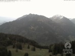 11:00
11:00 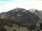 13:00
13:00 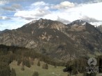 15:00
15:00 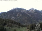 Latest