Around Me
Search
List
Map
Combined
+
+
Guide
Europe
Germany
Austria
Italy
Switzerland
France
Spain
Greece
Liechtenstein
Iceland
Czech Republic
Great Britain and Northern Ireland
Romania
Slovakia
Ireland
Belgium
Denmark
Norway
Finland
Netherlands
Portugal
Malta
Sweden
Serbia
Lithuania
Slovenia
Hungary
Ukraine
North America
USA
Canada
Costa Rica
Oceania
New Zealand
Australia
Asia
Japan
United Arab Emirates
China
Georgia
India
Azerbaijan
Turkey
Russia
Iran
Africa
Egypt
South Africa
South America
Brazil
Hiking
Europe
Austria
Germany
Italy
Switzerland
Liechtenstein
France
Iceland
Romania
Belgium
Ireland
Norway
Great Britain and Northern Ireland
Denmark
Sweden
Portugal
North America
USA
Canada
Oceania
New Zealand
Australia
Biking
Europe
Austria
Germany
Switzerland
Italy
Romania
Spain
Liechtenstein
Great Britain and Northern Ireland
Lithuania
Finland
France
Iceland
Ireland
North America
Canada
USA
Swimming
Europe
Austria
Germany
Switzerland
Italy
Romania
Iceland
Slovenia
Spain
Netherlands
Ireland
Malta
Great Britain and Northern Ireland
Hungary
North America
Canada
USA
Attractions
Europe
Germany
Austria
Italy
France
Switzerland
Spain
Greece
Czech Republic
Slovakia
Great Britain and Northern Ireland
Iceland
Belgium
Netherlands
Ireland
Denmark
Finland
Portugal
Malta
Liechtenstein
Norway
Romania
Serbia
Sweden
Ukraine
Hungary
Slovenia
North America
USA
Canada
Costa Rica
Oceania
New Zealand
Australia
Asia
Japan
United Arab Emirates
China
Iran
Georgia
India
Azerbaijan
Turkey
Russia
Africa
Egypt
South Africa
South America
Brazil
Magazine
News
Award
Active
Culture
Tips
Specials
On Tour
Inside
Hike From Restaurant Rosenberger Gut via Witikosteig to Dreisessel Mountain - Descent via Steinernes Meer - Image Gallery
Hike
Weather For Hikers
Webcams
Wall
Photos
From Restaurant Rosenberger Gut via Witikosteig...
Hike
Photos
Weather For Hikers
Webcams
Hikes
Europe
Austria
Germany
Bavaria
Bavarian Forest
Berchtesgadener Land
Allgäu
Zugspitz-Region
Tölzer Land
Passau and Surroundings
Chiemgau
Uper Palatine Forest
Bavarian Jura
Naturpark Altmühltal
Swabia (Bavaria)
Baden-Württemberg
North Rhine-Westphalia
Lower Saxony
Saxony
Rhineland-Palatinate
Thuringia
Brandenburg
Saarland
Saxony-Anhalt
Mecklenburg-Western Pomerania
Italy
Switzerland
Liechtenstein
France
Iceland
Denmark
Great Britain and Northern Ireland
All countries in Europe
Romania
Norway
Ireland
Sweden
Belgium
Portugal
North America
USA
Canada
Oceania
New Zealand
Australia
Magazine
News
Award
Active
Culture
Tips
All magazine categories
Specials
On Tour
Inside
Misc.
The Perfect Match
Travel Guide
Map
Sweepstakes
Surveys
Advertisement
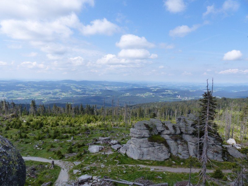
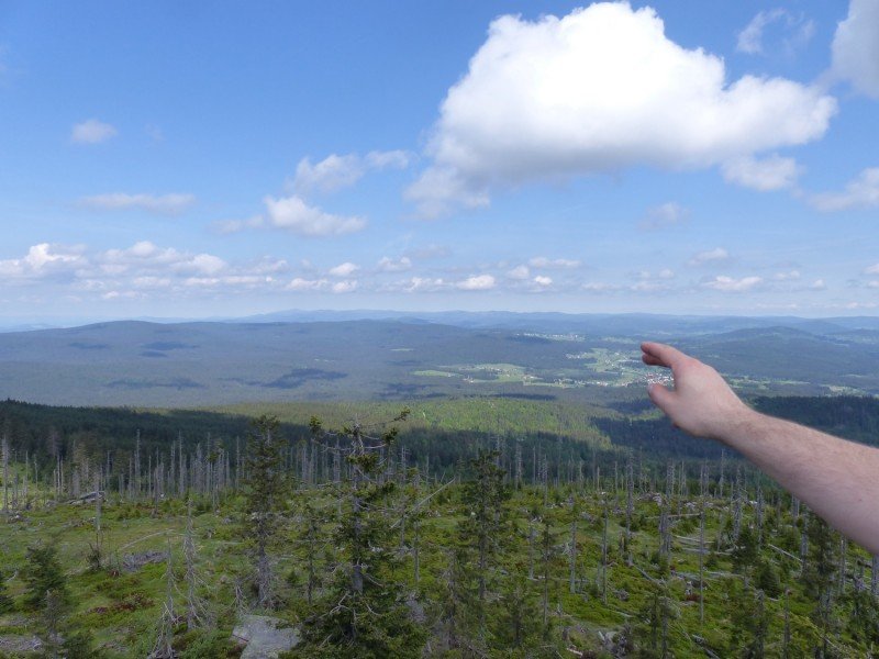
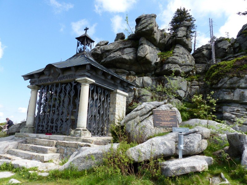
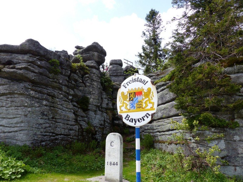
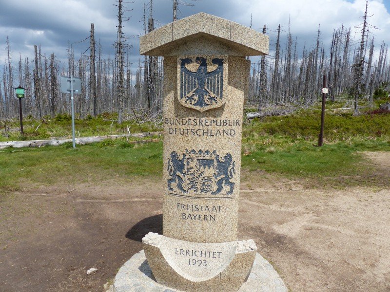
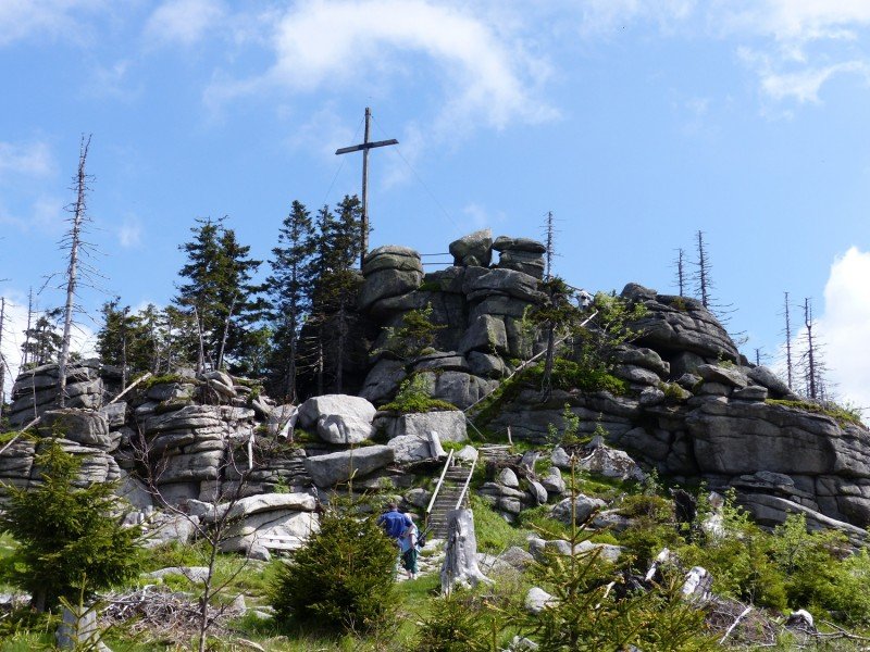
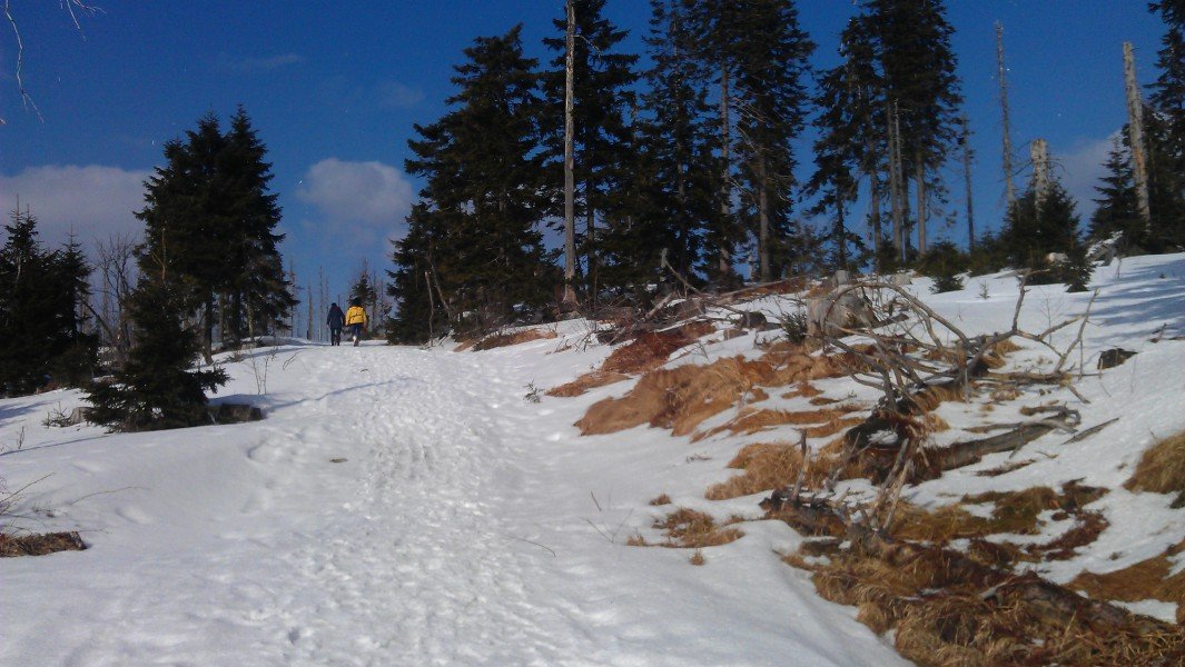
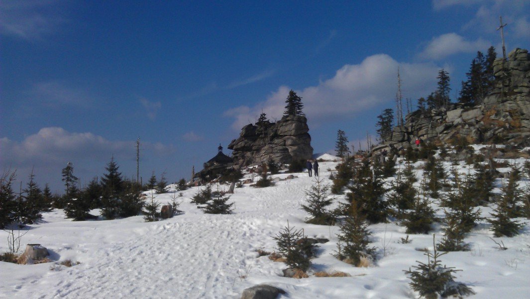
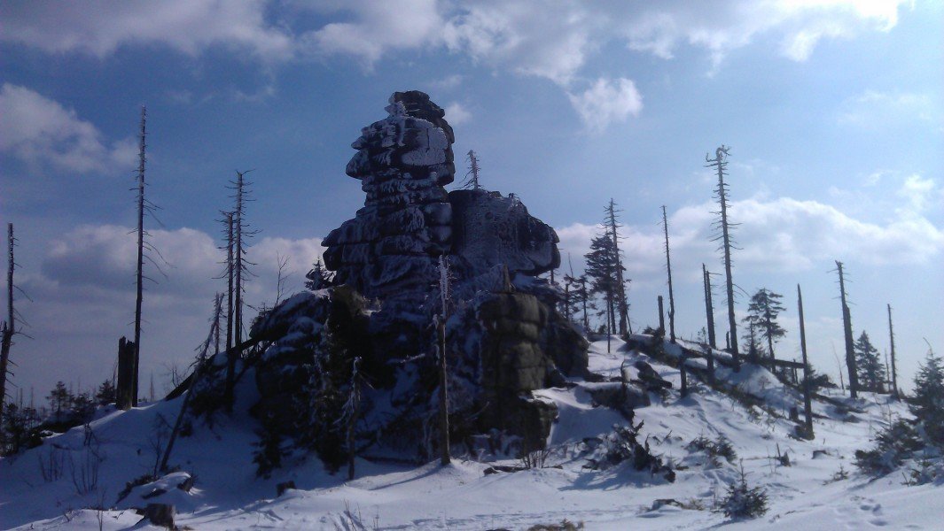
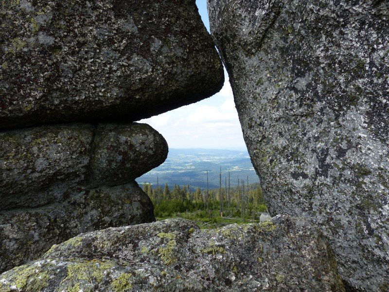
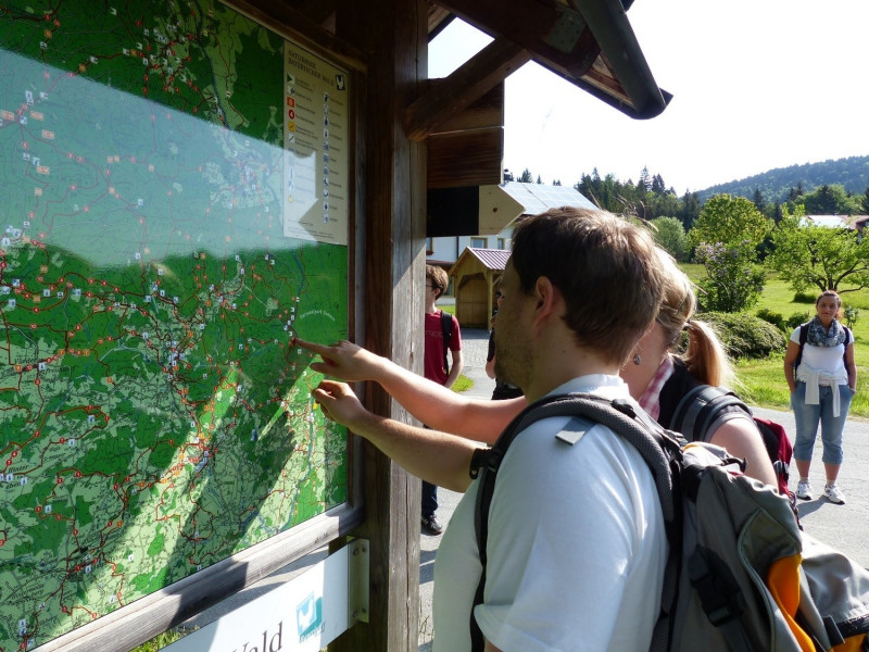
The beautiful south-west view from Dreisessel.
View from the peak of Dreisessel over the Bavarian Forest.
Bischof Neumann Chapel on Dreisessel
Hiking in Bavaria
At the trijunction, Germany, Czech Republic and Austria meet.
Dreisessel is among the highest peaks in the Bavarian Forest.
R. Brox
Dreisessel is also worth a visit in the winter.
R. Brox
Summit cross and chapel in the winter.
The stone formations are fascinating.
View from Dreisessel over the Bavarian Forest.
Berggasthof Dreisessel, a nice mountain inn.
A large board at the car park shows you the way.
Travel Deals & Tips
Advertisement
Weather
(674
m
)
Today
20
°C
Fri
15
°C
Sat
20
°C
Weather Forecast
Webcams
All Webcams
Travel Deals & Tips
Snow
Weather
Video
Webcam
Offer
Upper
cm
570
Lower
cm
0
Open Lifts
5/26
Current snow conditions at Stubai Glacier
Thursday
1
°C
Friday
-1
°C
Saturday
2
°C
Sunday
2
°C
The current weather at Stubai Glacier
Glacier Skiing almost all year long
Those of you who feel an irresistible desire to ski all year long are recommended to head to
Stubai Glacier
! The area boasts a huge variety of runs at 3,000 m, great snow coverage and fantastic views.
More
Advertisement
Advertisement
Advertisement
Nearby
Lake Klaffersee Klaffer am Hochficht
5.7
km
From Restaurant Rosenberger Gut via Witikosteig to Dreisessel Mountain - Descent via Steinernes Meer
7.8
km
Lake Plöckenstein via Mountain Hut Dreisesselhaus - Bohemian Forest
10.1
km
Show all
Path of Deceleration - Bohemian Forest (9 days, 165 km)
11.6
km
Path of Deceleration - Bohemian Forest (4 days, 71 km)
11.6
km
Path of Deceleration - Bohemian Forest (6 days, 115 km)
11.6
km
Rate the Hike
6
(5)
Share this page
Share
Tweet
Mail
Advertisement
Login
E-Mail
Password
Login
Forgot your password?
You don't have an account yet? Click here to get one.
Login with Facebook
Login with Google+
Share your personal insider tip and create new entries
Explore fantastic outdoor destinations when and where you want
Find your dream destination or discover the world on the interactive map