
Route description
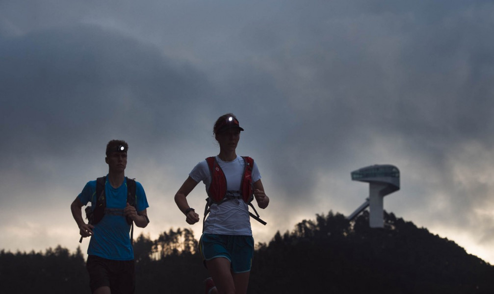
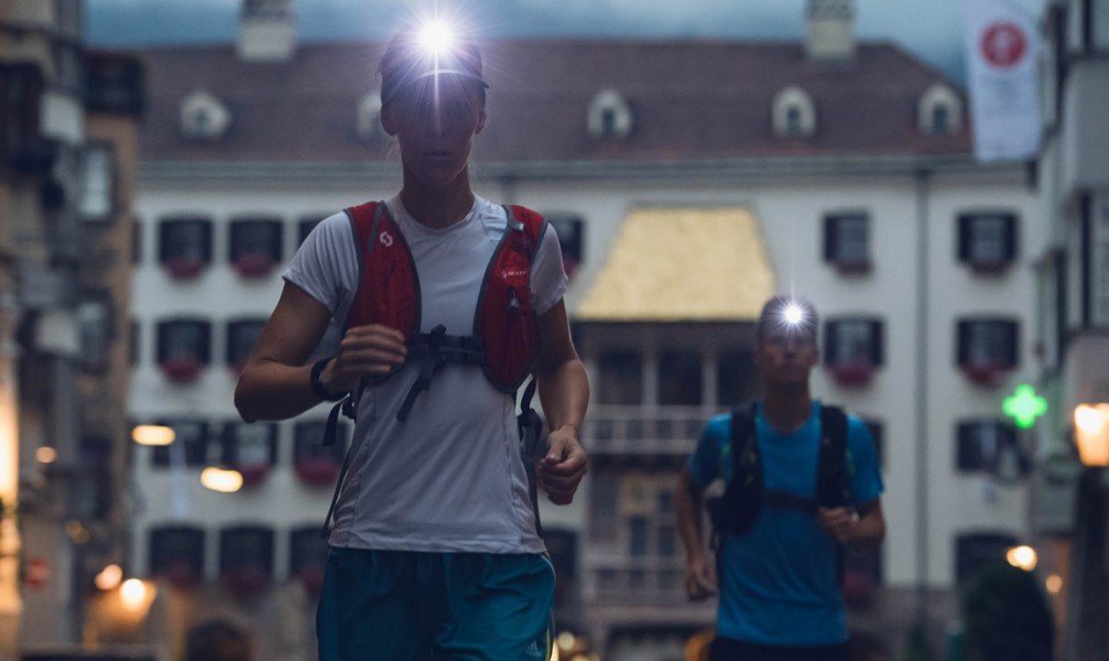
1 day, 63 kilometres and 5,116 metres in altitude - that's the Stubai Ultra Trail. It starts in the historic old town of Innsbruck. The destination is the Jochdohle on the Stubai Glacier at an altitude of 3,150 meters
The Stubai Ultra Trail is not a typical hiking trail, but a running trail. The route can of course also be hiked in stages as a multi-day hike, but here it is described as a 1-day run. Under the motto "city2glacier", the extreme run, which takes place annually in summer, leads from Innsbruck via the Sill Gorge into the Stubai Valley to the Stubai Glacier. With 5,116 meters of ascent and 2,554 meters of descent, the trail demands physical peak performance. Good preparation and appropriate equipment are therefore important prerequisites for mastering the route.
Stage 1: Innsbruck - Head of Stubai Valley
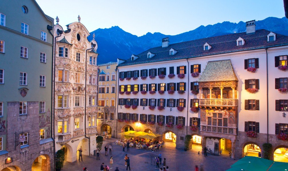
The starting point is the Golden Roof in Innsbruck's old town. From there the route follows asphalt paths along the river Sill and past the Bergisel ski jumping hill. Then the trail leads through the Sill gorge until you reach the beginning of the Stubai Valley.
Section 2: Front Stubai - Schlick - Starkenberger Hut
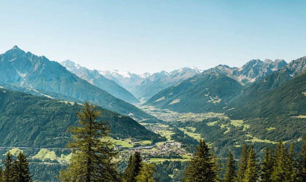
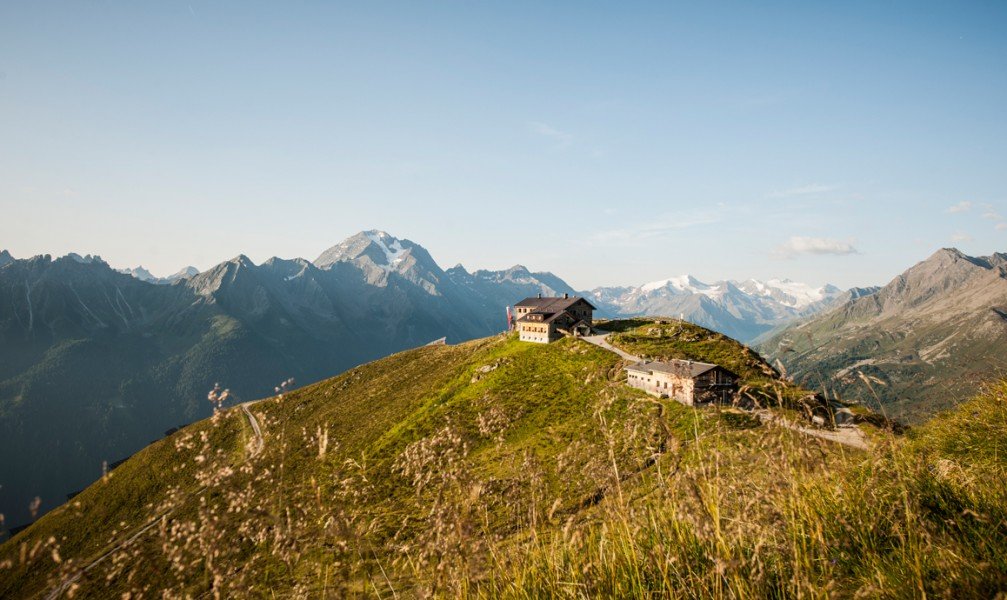
Arrived in the Stubai Valley, the route opens up a magnificent view of the Serles. The woody Stollensteig trail runs along the Ruetzbach stream to Telfes. Here the first big challenge awaits the runners: the ascent to the Starkenburger Hütte (2,237m). That's 14 kilometres and 1,250 metres in altitude that have to be conquered. The route leads through the Plövener Loch over the Schlicker Boden to the hut, which rewards the effort with an impressive view over the Karwendel mountains, the Zillertal Alps and the glaciers around the Zuckerhütl. Afterwards you walk on stairs back into the valley to Neustift.
Section 3: Neustift - WildeWasserWeg - Mutterberg
The next section starts with a breather, because the trails from Neustift to Volderau rise only slowly. Then you come to the WildeWasserWeg, which leads through the gorge of the Ruetz cataract to the imposing Grawa waterfall. From there it is not far to Mutterberg, where the last section begins.
Section 4: Final ascent to the Stubai Glacier
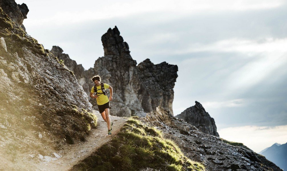
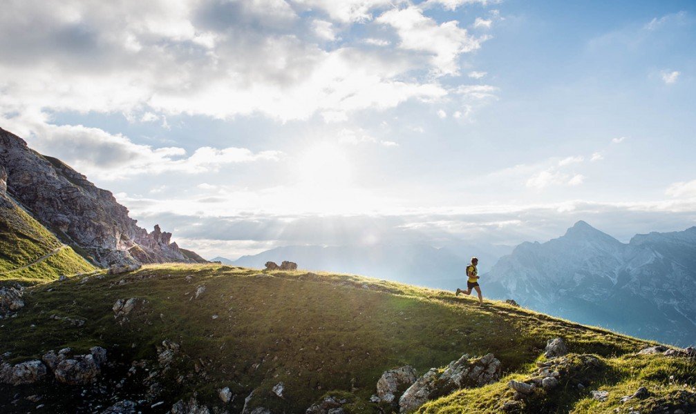
The final spurt is a real challenge: 1,300 metres in altitude are waiting to be climbed. On steep serpentines it goes first from the valley station of the Stubai Glacier cable cars up to the Dresdner Hütte. Then the ultra trail runs over stone, snowfields and ice to the Jochdohle mountain restaurant, the finish at 3,150 metres above sea level. At the top, the reward is not only a finisher shirt, but also a breathtaking panorama of the Stubai Glacier and more than 100 three-thousand-metre peaks. The view from the Top of Tyrol summit platform, which is only a few minutes away from the Jochdohle, is particularly beautiful.
Where to eat
Of course, there is not much time for a leisurely stop during an extreme run like the Stubai Ultratrail. That's why there are a total of ten refreshment stations along the route. The first station is located after about 9 km at the Stephansbrücke. Before the first big climb up to the Starkenburger Hütte, you can fortify yourself in Telfes at the Pfarrach Alm car park. There is also refreshment at the Starkenburger Hütte itself, where you have completed the first half of the route. Between Neustift and Mutterberg there are stops at the leisure centre, the Doadler Alm and the WildeWasserWeg at the Tschangelair Alm. For the final spurt, you can recharge your batteries at the valley station in Mutterberg, the Dresdner Hütte and the Eisgrat mountain station
Interesting facts
- With an overall length of 63 km the hike is among the 15 longest hikes in Austria available on TouriSpo.
- Elevated between 575 m and 3,137 m, the hike is among the 3 highest elevated hikes in Austria. You're facing an uphill climb of 4878 vertical meters on this hike. This is quite much. You should be fit to do this track. This makes the hike one of the 10 hikes with the most ascent in Austria.
- In case of good weather conditions, the hike can also be done without bringing your hiking boots. There are places to buy beverages and food along the track. However it’s always recommended to bring enough water and food along with you.
Video
Highlights of the tour

A highlight of the tour is the WildeWasserWeg in the third section. It first leads through the gorge of the rushing Ruetzbach. Once you have passed this Ruetz cataract, you come to the mighty Grawa waterfall, which, with a width of 85 metres, is the widest waterfall in the Eastern Alps
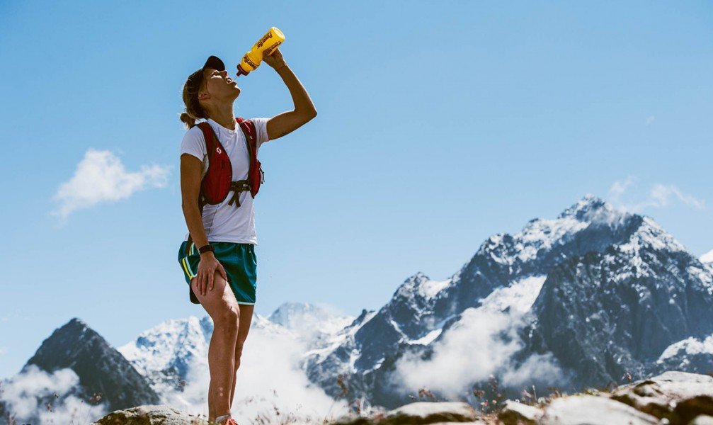
Equipment
- Trail running shoes with profile sole
- Running backpack
- Rainwear or rain protection
- Warm clothing (top and long trousers or leg warmers) as an insulating intermediate layer under the outerwear
- Gloves and hat
- Functioning headlamp with spare batteries or accumulator
- Water container (at least 1.5 litres)
- Emergency equipment
- Navigation watch with stored GPS track (alternatively detailed route maps in printed version)
- Mobile phone with stored emergency number
- Cup for drinks at the refreshment points
Getting here
Starting point is the old town of Innsbruck. From Munich, take the A8 to Rosenheim. At the motorway junction Dreieck Inntal keep to the right and take the A93 towards Brenner/Innsbruck/Austria. In Austria, the motorway becomes the A12, which leads to Innsbruck.