

Description
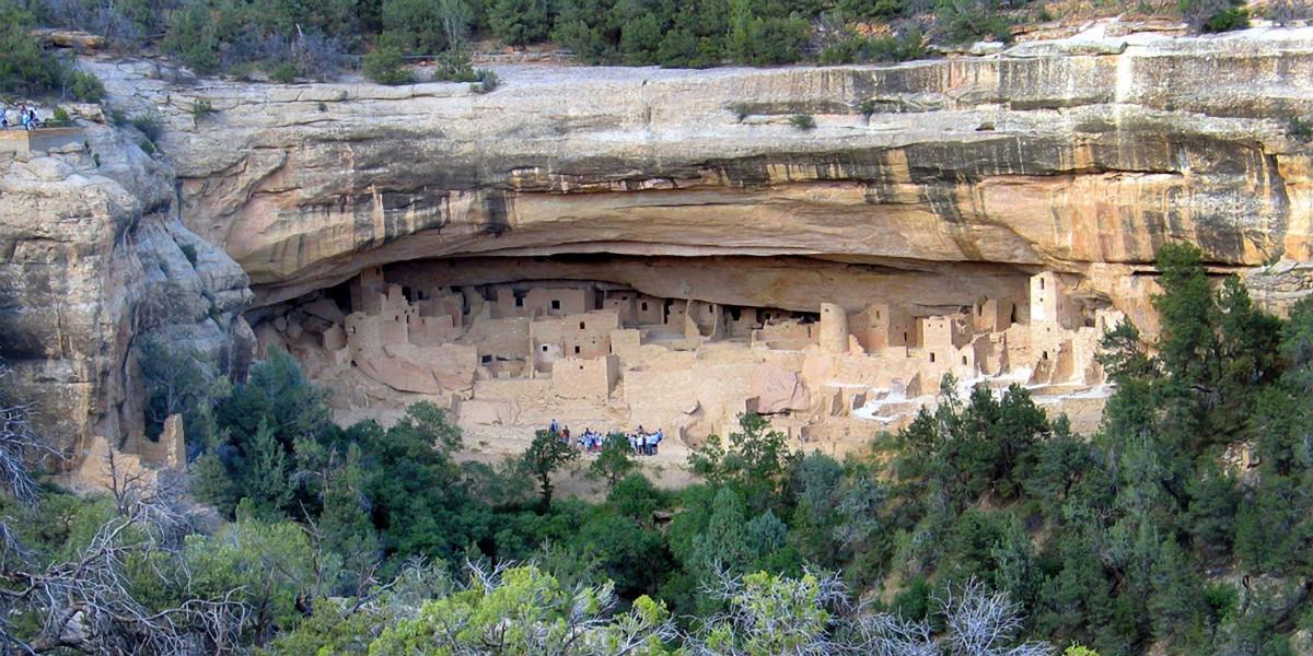
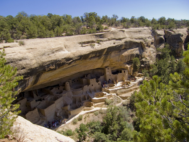
Mesa Verde National Park is one of the most important historical sites in the USA and is the biggest archeological protected area in North America. The native inhabitants of the region around Cortez, the Anasazi Indians – also called Ancestral Puebloans - lived here between 550 and 1300 after Christ and left unique traces of their culture. The park is foremost known for the housing constructions, which they created in the past 100 years of their settlement: 600 unique dwellings, built in the rocks of Mesa Verde.
The UNESCO World Heritage Mesa Verde
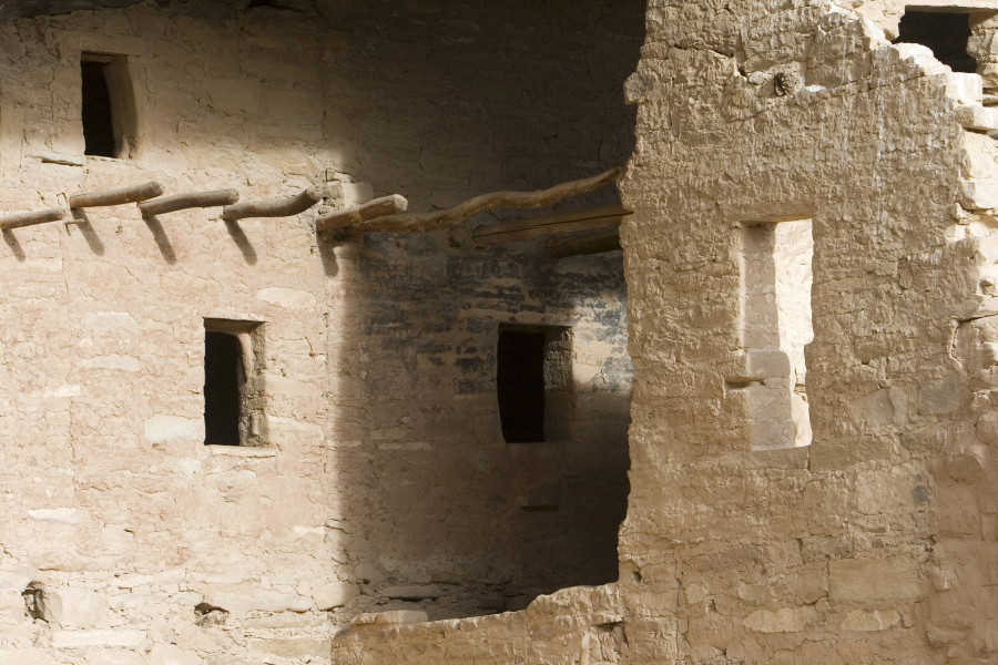
To this day, 5,000 archeological sites, created during 700 years of settlement, have been discovered in the national park. Besides the famous rock constructions with storage areas and villages with up to 150 dwellings, the UNESCO World Heritage includes pit houses from the beginnings, towers and stone made so-called Pueblos. While older dwellings are located at the summit level of the table mountains, the famous rock settlements lie directly below the summit, built into the rocks. In order to visit them you should be physically fit, as you will need to climb ladders, walk steep paths and crooked stairways.
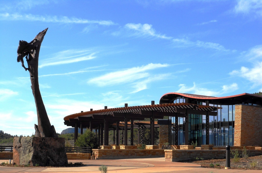
Just after the entrance to the national park, you will find the Visitor and Research Center. You should plan your first stop here. They have plenty of information as well as exhibitions about the life of the Ancestral Puebloans, the descendents of the indigenous peoples, as well as artistic works on Mesa Verde. Furthermore, you can get tickets for a visit to the cliff dwellings Cliff Palace, Balcony House and Long House, which you are only allowed to access together with a park ranger.
Afterwards follow the road through the national park. There are viewpoints again and again, where you can take breaks and enjoy the surrounding nature. The best view you will find is at Park Point Overlook, which is at 2,614 meters (8576 feet) the highest point of the national park. It offers an amazing 360-degree panorama view. Along the road there are many starting points for hiking trails, which lead through the beautiful nature of Mesa Verde. Please note, though, that you should not leave the signposted trails.
Chapin Mesa
The road splits at Far View Terrace. It is your choice whether you want to explore Chapin, or Wetherill Mesa. If you decide for the mountain Chapin Mesa, you will soon reach Far View Sites, which in past times was the most densely inhabited area. Almost 50 villages have been discovered here within an area of 1,2 square kilometers (about 0,46 square miles). A round tour of 1,2 kilometers (0,75 miles) leads you to the remains of some of them. Follow the road further, and you will get to the Cedar Tree Tower site. Towers were built between 1100 and 1300 and probably served as kiva, a meeting or ceremony room. You could then add a visit to the Chapin Mesa Museum. It was opened in 1924 and shows an exhibition about the Anasazi Indians with artifacts and information about their culture. A 25-minute movie explains the history of Mesa Verde.
Next to the museum you will, too, find the cliff dwelling Spruce Tree House. During winter you can visit it on a guided tour, in summer you can discover it on your own. There are 130 very well preserved spaces, which were created between 1211 and 1278. Into the rocks of Chapin Mesa, the Anasazi Indians also built Cliff Palace and Balcony House, both of which can only be visited with a guided tour. With over 150 rooms and more than 20 kivas, Cliff Palace is the biggest and most prominent of all of the settlements. Balcony House shows most clearly, how the inhabitants built their houses and how the constructions changed with the years. As you need to climb a ten meter long ladder in order to reach the settlement, it is known to be an especially adventurous one to visit.
Wetherill Mesa
The second mountain, Wetherill Mesa, lies in the West and is commonly not visited much. On a high plateau you can visit Badger House Community. A 45-minute round trip brings you to the different buildings, among them pit houses and a basketry. As they stem from the time of 650 to about 1300, the way leads you through the 600-year history of the former inhabitants. The Mesa also has two more rock settlements: Step House and Long House. You can discover Step House without a tour – the name speaks for itself. To get there, it is a steep and curvy thirty meters downhill. Besides a basketry from the year 626, you will also find those renowned pueblos made from stone. Long House, the second largest settlement in Mesa Verde, can be visited together with a park ranger.
Because there is so much to discover in Mesa Verde National Park, it is advisable to spend more than a day here. You can stay overnight at the Far View Lodge or camp on Morefield Campground.
Historical Information
From about 550 to 1300 after Christ, the area of Mesa Verde was inhabited by the Anasazi Indians. For the most part they lived at summit level. Only in the last 75 to 100 years of their settlement they created impressive housing constructions below the plateau in the table mountains rocks. It is assumed that, firstly, they chose this space to protect themselves from animals and the elements of nature. What is more, the stone niches served as a water supply, as springs rose from the rocks. This way, they could continue their agricultural work on the high plateau, and live in protection of the rocks. However, the natives did not live here for long. From about 1300 after Christ, they started moving towards New Mexico and Arizona. The reasons for this are unknown.
Mesa Verde was discovered again towards the end of the 19th century. The first photographs of the historical settlements stem from the year 1874. From 1888 onwards, the Weatherill Brothers started collecting archeological findings and mapping the rock settlements systematically. They were supported by Swedish Gustaf E. A. Nordenskiöld, who is known to be the first scientist to explore Mesa Verde and to write an extensive study about it. In 1900, Virginia McClurg and Lucy Peabody founded the Colorado Cliff Dwellings Association, to support the preservation and protection of the site. In 1906, Mesa Verde was declared national park by president Theodore Roosevelt. It is thereby the seventh oldest national park in the country. When the UNESCO first started declaring cultural and natural monuments as world heritage in 1978, Mesa Verde was also on their list. New findings and sites of the Anasazi Indians are discovered continually to this day.
How to get there
Mesa Verde lies in the southwest of Colorado between Cortez and Durango. The highway 160 brings you from both cities to the entrance of the national park, the exits are signposted accordingly. Starting in Cortez, you reach the exit after 16 kilometers (about 9,5 miles), coming from Durango it takes about 58 kilometers (36 miles) to the exit.