Hike Path of Deceleration - Bohemian Forest (4 days, 78 km) in the Bohemian Forest: Position on map

Webcams around the Hike Path of Deceleration - Bohemian Forest (4 days, 78 km) (Bohemian Forest)

Path of Deceleration - Bohemian Forest (4 days,...
Advertisement
Schöneben Ulrichsberg
Elevation: 935 m
This webcam shows Schöneben near Ulrichsberg in Austria, a great spot to go hiking.
50 minutes ago
INNs HOLZ, Schöneben
Elevation: 938 m
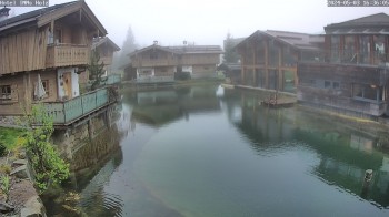
Here you can see Hotel INNs HOLZ in Schoeneben
4 minutes ago
Ulrichsberg, Golfpark Böhmerwald
Elevation: 660 m
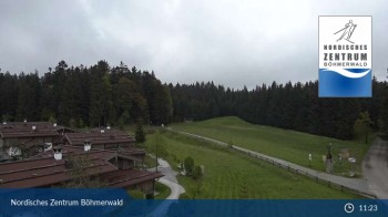
Your view of the golf course Böhmerwald in Ulrichsberg, which is a village in Upper Austria.
59 minutes ago

Webcam is Missing

A webcam is missing? Do you know the source of another one?

All Webcams on the map

Travel Deals & Tips
Advertisement
Advertisement
Advertisement
Advertisement
Login with Google+
  • Share your personal insider tip and create new entries
  • Explore fantastic outdoor destinations when and where you want
  • Find your dream destination or discover the world on the interactive map